08 Aug La Chapelle d’Abondance to Refuge de Chésery – D3
We seem to have survived another day. Slightly longer than yesterday and with more ascent but much more gradual. For the data-hungry there’s a link to the Garmin readout.
But first, back to last night and a splendid home cooked meal of leak and potato soup, potato gratin and fresh fruit and yoghurt for desert. The highlight wasn’t the food but our delightful waitresses – the charming six-year-old daughters of the manager of our Gite d’Etape earning their holiday money in a most professional and courteous way. They earned a nice fat tip for their efforts.
The GR5 starts with a bang from St. Gingolph to La Chapelle d’Abondance – a distance of 22km, which Richard had wisely split with a night at Novel. I should point out that, apart from being a renowned hip and knees surgeon and an author of some acclaim, he is also an International Mountain Leader of some considerable experience.
His route planning for the GR5 has been spot on, all of it done by him while I was loafing around in Moscow. We’ve both agreed that Paddy Dillon’s daily legs are very challenging for most amateur hikers. We’re already meeting some who are splitting down some of his ‘one day walks’ into two days. The graphic below show’s today’s route and elevations. They are taken from Dillon’s The GR5 Trail by Cicerone.


We’re managing it just fine, but the heat and the requirement to imbibe half a litre of water for every hour’s hiking had us filtering water from streams today.
Today’s start was in marked contrast to yesterday’s – a gentle stroll across dewy meadows and a gradual climb past a waterfall and on through cool woods. This led eventually to higher open ground and an exposed shoulder called Monte de Grange. As we emerged from the cool of the wood the sun hit us again forcing us into numerous water stops.

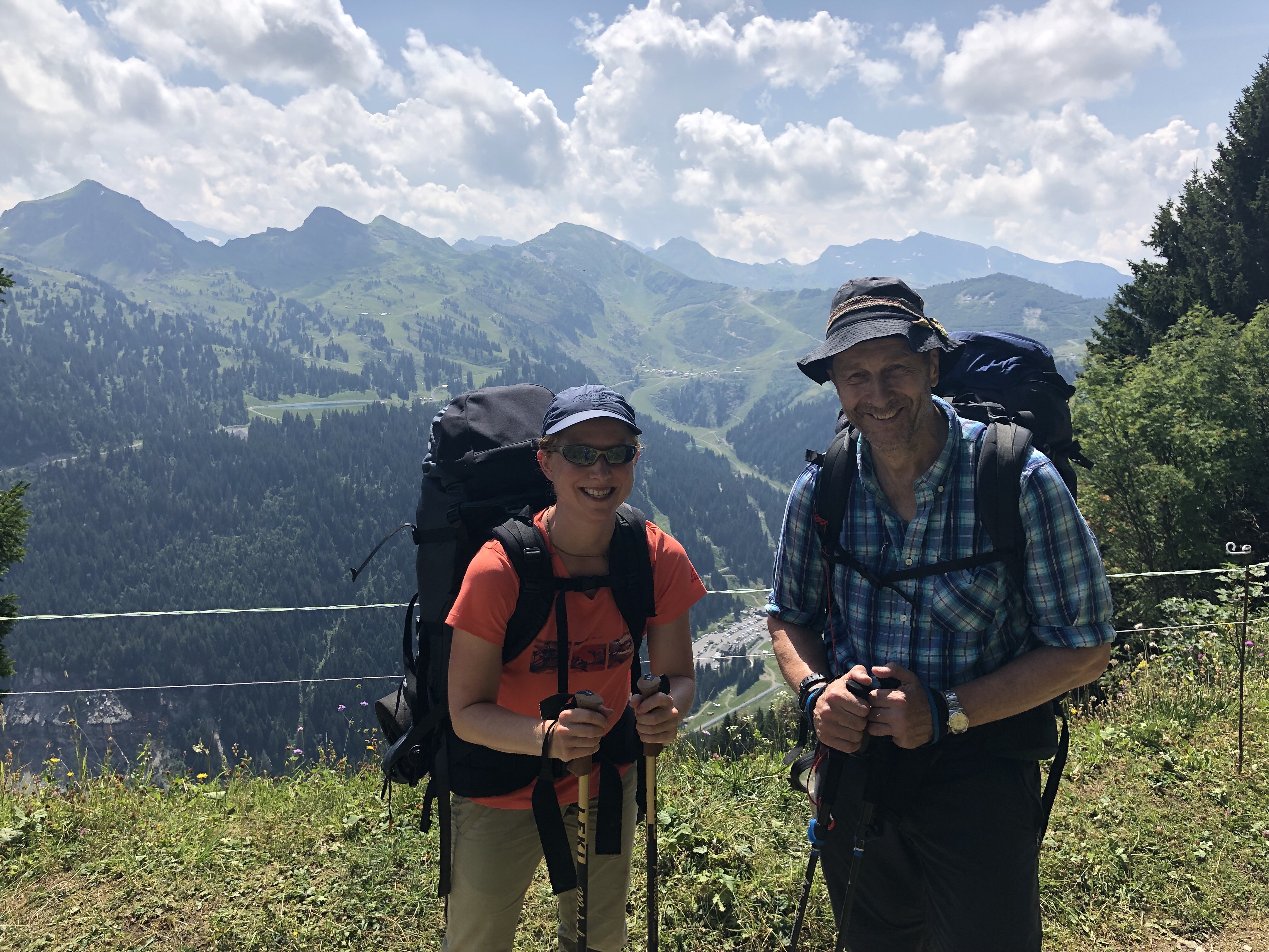
I take my hat off to Richard. He is literally carrying his ‘office’ and suffering for his art. Despite my somewhat tongue-in-cheek introduction of him yesterday, he is an excellent travelling companion, with vast experience of mountaineering.

We were comparing notes about the real-life difficulties of evacuating casualties from remote areas. The complications can be horrendous. He was the doctor on a British Army 1984 Everest expedition. They were about to make a final push for the summit when a group further up triggered an avalanche which killed one soldier and severely injured another. Getting the injured soldier off the mountain and back to treatment is a saga best related by him. If you’re interested, check out the story in his book Knife Edge (Vineyard Press). So, I feel quite safe in his company, for obvious reasons.

The intrepid Stef (above left), the German free camper, caught up and overtook us while we were still in the cool of the wood. Several miles later we caught up with her while she was filling up from a stream. We did the same not wishing a repeat of yesterday’s water deficit drama and, God forbid, renal failure – a very extreme outcome of dehydration. So, we walked together for a while as Richard explained in some medical detail the method for checking where your are on the deficit scale. It’s all to do with the absence or otherwise of the need to pass water. If you’re chucking litres of water down your neck and you still don’t need to pee you’re in deficit even though your belly is full to bursting with water.
I learned something similar in the Sinai desert when I was criss-crossing it on foot for 28 days with some Bedouin tribesmen. You can figure out if you have a salt deficit by putting some in your mouth. If it tastes like sugar you need more salt. As soon as it tastes like salt again you’re salt levels are where they should be. Good to know.
After some five hours and 15km of baking hot walking in little shade we eventually staggered up to a cafe/bar/restaurant/refuge at Col de Bassachaux at 1800m for a much needed water stop for Richard and a cafe au lait for me and Lego Tatiana!


We were heading for Refuge de Chésery at 1980m some 6km from Col de Bassachaux, so that final distance with little in the way of serious climbing turned into a pleasant amble. The only danger was the squadrons of mountain bikers who didn’t seem to care who mowed down. But, we survived them and arrived at the refuge which is technically just inside Switzerland.


The Refuge de Chésery is cosy wooden cabin with very friendly Swiss staff, a warm shower, good home cooking and electricity. We immediately set to recharging our various devices through a spaghetti junction of cables.

The world is indeed flat and one is in danger of falling off the edge. The French mapping on the Gaia App ends abruptly at the border, rendering the world beyond entirely white and mysterious. Despite the fact that the next leg of the GR5 takes us from this refuge and through Switzerland for several miles before dipping back into France, the French mapping people refuse to admit to its existence. So, we’re going to have to navigate blind for a while tomorrow. The arrow in the picture below is where we are in Switzerland.

So, that’s another day done and a tiny segment of the GR5 nibbled off. You can only eat this elephant one mouthful at a time. It’s pouring and thundering outside. Maybe we’ll have a rain-soaked day tomorrow en route to Samoëns or maybe we won’t.
Stay tuned!
Hiking vital statistics:
https://connect.garmin.com/modern/activity/2916163285